
Life-threatening flash flooding and severe thunderstorms, including tornadoes, are possible this morning from parts of the Southeast into the Ohio Valley and Appalachians.
(LIVE BLOG: Latest News and Updates)
Happening Now
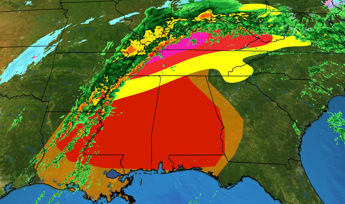
A squall line is pushing eastward through the Deep South with damaging winds, heavy rain and a few tornadoes, as you can see in the current radar image below. Areas in tornado watches are shaded in red.
Flash Flood Emergencies have been issued for Tazewell County in western Virginia and for Mercer and Summers counties in West Virginia.
(EXPLAINED: What Is A Flash Flood Emergency And What Should You Do About It?)
Grundy, Virginia, saw rushing water sweeping through town Saturday afternoon. Multiple swift water rescues have occurred near Princeton, West Virginia. Numerous roads are impassable in southern West Virginia and western Virginia due to flooding. More than five inches of rain has led to flash flooding and the increased likelihood of land- and rockslides.
Flooding was reported in parts of Clarksville, Tennessee, about 40 miles northwest of Nashville near the Kentucky border, early Saturday. Water rising up to property has recently been reported in northeastern Tennessee.
Some roads in Kentucky have been washed out. At least one vehicle has been pushed off the road in Corbin, Kentucky, and a swift water rescue was performed Saturday morning west of Bowling Green.
Rare ‘High Risk’ Flood Outlook
Heavy rainfall spread across the South and central Appalachians through Sunday morning.
Heavy rain across the South and central Appalachians fell on ground saturated from multiple rounds of rain over the past several days. Melted snowpack from Winter Storm Harlow earlier is also contributing to streams, creeks and rivers running high right now.
Given all this, NOAA’s Weather Prediction Center issued its highest level of excessive rainfall threat from western Tennessee into Kentucky.
This rarely-issued high risk highlights what could be a “very impactful, life-threatening and significant heavy rainfall and flash flood event”, NOAA-WPC wrote in their Friday afternoon forecast. WPC also noted this moist, unstable setup is “anomalous for mid-February”.
(PERSPECTIVE: Why ‘High Risk’ Flood Outlooks Are Important)
Dozens of river gauges reached moderate flooding levels across the Deep South and Ohio Valley, according to the National Water Prediction Service. More gauges are likely to reach moderate and major flood stage as water continues to run downhill.
As of…
Click Here to Read the Full Original Article at Yahoo News – Latest News & Headlines…